During the ride, I will post the history of the counties through which I pedaled that day.
(Copyright 2004 – Nebraska Association of County Officials)
http://www.nacone.org/webpages/counties/mappage/counties.htm
JUNE 1
Hall – 8 – Grand Island
When Maj. Stephen H. Long, a Union government engineer, passed through this area in 1820 while returning from an expedition in the Rocky Mountains, he reported the area was "wholly unfit for cultivation and uninhabitable by a people depending on agriculture for their subsistence." Long's harsh observation would prove to be erroneous, however.
 |
| Hall County Courthouse - Grand Island |
Hall County was created by the Territorial Legislature on Nov. 4, 1858. The county's original boundaries would be redefined again in 1864 and 1871. This new county was named in honor of Augustus Hall, who was Chief Justice of the Territorial Supreme Court at the time the county's original boundaries were created.
The Mormon Trail brought many of the first settlers to the Hall County area. But like so many other counties that border the Platte River, the westward advancement of the Union Pacific Railroad in the 1860s can be credited with contributing to the most significant development.
One of the sidings located along the rail line was approximately two miles north of a settlement on the north bank of the river. The settlement was relocated to the site of the siding and renamed Grand Island City. Within six years it would be incorporated and become the county seat. The name, later shorted to simply Grand Island, was derived from a large island in the river.
The stately courthouse that today serves the county was completed in 1903 and has been listed on the National Register of Historic Places. In 1980 the county added an Administration Building directly across the street. The courthouse is used primarily for the courts and county corrections, with the other county offices housed in the Administration Building.
The roots of Howard County can be traced back to a pair of government surveyors. After years of surveying throughout the country, J.N and N.J Paul became interested in the central part of Hall County. At the urging of the Pauls, the Legislature adopted an act in March 1871 to divide Hall County and establish boundaries for a new county to be called Howard. The name was selected to honor Civil War Gen. Oliver Otis Howard.
 |
| Howard County Courthouse, St. Paul |
As the 1870s progressed, Howard County began to grow. Settlers coming to the area were said to be young, well-educated, adventurous Easterners seeking to make their fortune in "The Great American Desert."
The first permanent settlement in the county was made by the Pauls in the spring of 1871. When it came time to name the settlement, N.J. Paul suggested Athens. A petition was sent to the Postal Department in Washington for the establishment of a post office called Athens in the settlement. The petition was returned because there was already a post office by that name in the state. Phineas W. Hitchcock, and U.S. senator from Nebraska, suggested the name of Saint Paul, in honor of the settlement's founders. It became St. Paul and eventually the county seat.
As with most county seats, the courthouse in St. Paul was the focal point of the community. When the cornerstone was laid for the building on June 5, 1913, an all-day celebration was planned. It included a parade, ball games, races, fireworks, speeches and ceremonies. It was estimated that more than 6,000 people attended the celebration. The three-story Bedford stone "pride" of St. Paul still serves the residents Howard County today and in 1988 a 75th anniversary celebration was observed.
Over the years the courthouse has been home to more than just county offices, a jail and the courtrooms. At one time the community's public library was located on the third floor and the Grand Army of the Republic once occupied one of the first floor rooms. In return, the latter agreed to build a monument on the front lawn of the courthouse in honor of veterans of the Civil War. The monument still stands today.
Nance – 58 – Fullerton
For many years the Pawnee nation lived at peace on the rolling prairie lands along the Loup River. The Pawnee sustained itself by raising crops and hunting wild game that thrived in the area. In time, this area was designated as the Pawnee Reservation.
 |
| Nance County Courthouse - Fullerton |
The first white settlers to come to this area were a group of Mormons led by Henry James Hudson in 1855. One-hundred families established a colony on the site that today is Genoa. The colony prospered, but in 1860 the Pawnees claimed the territory as part of their reservation. The Mormons attempted to stay on the land, but the danger resulting from conflicts between the Pawnee and Sioux tribes forced them to move on in 1864.
Twelve years later Randall Fuller came through the area with a cattle herd on his way to the Black Hills. By this time the reservation land was being parcelled off and Fuller bought two sections. He laid out the townsite of Fullerton, today the county seat.
When the county was organized and its boundaries defined in 1879, it was named in honor of Albinus Nance, who was governor at the time. In his proclamation, Nance, who was a mere 30 years old, selected Fullerton as the temporary county seat until an election could be held. At the time, Fullerton, which was located in the fertile valley between the Loup and Ceder Rivers, consisted only of rows of stakes marking the townsite. Fuller pledged six acres of land to the county in exchange for it being named the county seat. When the county was organized, it sold the lots to build the first courthouse. Two years later, Fuller donated 10 acres to Nebraska Wesleyan University when it relocated from Osceola to Fullerton. The university operated in Fullerton for several years before moving to Lincoln in order to be closer to the center of the state's population.
In a special election in 1894, voters approved a $17,000 bond issue to build a new courthouse. Within a year, the Board of Supervisors met in the building for the first time. This building served county residents until the present $440,000 courthouse was built in the 1970s.
Merrick – 46 – Central City
 |
| Merrick Count Courthouse, Central City |
Merrick County could literally be called a "panhandle" county, but not because of Nebraskans' general reference to the 11 counties which are located in the state's Panhandle region. Rather, a series of events at the time Merrick County's boundaries were created resulted in the county having narrow "panhandles" on both the northwest and northeast corners.
When the Legislature laid out the county in 1858, the northern boundary was a straight line. The preceding year a reservation had been established for the Pawnee tribe and Merrick County took in about half the reservation. As the Pawnee tribe gradually moved to Oklahoma, the Legislature adopted an act to create Nance County from the southern 180 square miles of reservation, all of which were located within Merrick County. Since the Pawnees had wanted both banks of the Loup River included in their reservation, the boundary line was jogged to roughly parallel the Platte River. Thus, Merrick County today has a jagged northern boundary, with narrow "panhandles" on both corners.
The county's history dates back to the pioneers who were headed west along the Oxbow Trail. The Western State Company used this route to carry mail between Omaha and Fort Kearny. It established a station about three miles southwest of what today is Central City. Known as "Lone Tree Station" because of a lone cottonwood tree, it became a welcome resting point for weary travelers.
When Merrick County was established, it was named in honor of Elvira Merrick, wife of territorial legislator Henry W. DePuy of Dodge County. At the same time, a settlement name Elvira was named the county seat. The advancement of the railroad contributed much to the development of Central City, a town given this name because it was centrally located in the agriculture region of the state. With its development, Central City became the county seat and eventually Elvira ceased to exist.
Before a courthouse was built in the 1870s, county offices were housed in the residences of various officials.
June 2
Polk – 41 – Osceola
 |
| Polk County Courthouse - Osceola |
When the county was organized in 1870, there was no county seat or courthouse. Each county official who had been elected at an August election conducted county business from his residence.
In October 1871, county residents voted to make the settlement of Osceola the county seat. County commissioners approved the construction of a frame courthouse and took possession of the building when it was completed in 1872. Unfortunately, the courthouse was destroyed by fire nine years later and many of the county's documents were lost.
One year after the destructive fire, a new courthouse was opened. The brick building, which cost $10,000, became a source of pride for county residents. With the publicity the courthouse received when it opened in 1882, it was soon being visited by people from outside the county. In fact, an excursion train was run from David City in neighboring Butler County to bring visitors to see the new building.
As the 20th century began, like so many other counties in the state, Polk County found itself outgrowing its courthouse. So in 1922 the present courthouse was constructed. The three-story building was an architectural landmark. Around a steel reinforced frame was built a modern renaissance exterior that featured terra cotta trim. The interior of the building was highlighted with marble stairs and wainscoting.
Polk County was developed as an agricultural area. Despite severe storms, blizzards and an infestation of grasshoppers in the 1870s and 1880s, those who made a living off the land persevered. That same hearty spirit is prevalent today as the county's economy is based primarily on family farming and livestock production.
Platte – 10 – Columbus
 |
| Platte County Courthouse - Columbus |
In the summer of 1856, advance agents from the Columbus Town Company came to the area from Columbus, Ohio. Upon reaching the Loup River the agents marked the site for a future town to be called Columbus. The new settlement quickly grew and soon had a mill, hotel and general store. The first meeting of the Board of Commissioners was conducted in December 1857 in a log house and it would be more than 10 years before the county would have a courthouse.
When the Union Pacific Railroad headed west through Columbus in 1866, the area's growth accelerated at a faster pace. The following year a special election was held to approve the issuance of $16,000 in bonds to build a courthouse and jail. Construction was completed in 1870.
Another boost to the county came in 1881 when the Atchison and Nebraska Branch of the Burlington and Missouri River Railroad constructed a rail line connecting Columbus with Lincoln. Columbus rapidly became a flourishing railroad center and commerce hub.
The courthouse that was completed in 1870 was soon outgrown by the county. On June 26, 1922, the current courthouse was dedicated. The Grecian-Ionic style structure occupied a quarter-block in downtown Columbus when it opened. But in the early 1970s, the need for additional space once again became apparent and a $1.76 million addition opened in September 1976. The two-story addition houses the sheriff's office, civil defense office, County Board room, treasurer's office and the courtrooms.
Platte County enjoys a diverse economy today. Farming and livestock production, along with manufacturing, lead the way. Among the many manufacturing operations to locate in the county is Lindsay Irrigation, known worldwide for its center pivot systems.
Colfax – 43 – Schuyler
 |
| Colfax County Courthouse - Schuyler |
The organization of Colfax County came 56 years after the first documented report of white men traveling through the Platte River Valley. Seven members of a John Jacob Astor exploration party are said to have been returning from the Pacific Northwest when they came upon the broad valley that was inhabited by the Pawnee tribe. Over the ensuing 30 years an increasing number of traders, trappers, gold miners, and Mormon settlers passed through the area.
Farmer Daniel Hashberger settled near the future site of Schuyler in 1864. Within two years the Union Pacific Railroad was pushing westward and the Shell Creek station, later to become Schuyler, was established. By 1869, when the site was selected as the county seat, the railroad was the sole owner of the property at the site. Schuyler was incorporated in 1870.
When Colfax County was created it was actually divided from Platte County, whose inhabitants objected to the split. An agreement was worked out whereby Colfax County would assume its proportionate share of county indebtedness that existed at the time of the split.
As Schuyler and the surrounding area began to develop, it became apparent that a courthouse was needed. By 1872 a two-story brick and stone building was completed, complete with a tin roof and an ornamental tower. An interesting note is that the first floor was used for apartments for county officers, as well as for cells for prisoners. The second floor housed the court room. This building would serve Colfax County until 1922, when the present brick and terra cotta trim courthouse replaced it.
Butler – 25 – David City
 |
| Butler County Courthouse - David City |
Butler County's boundaries were defined by the Territorial Legislature in 1856. It was formally organized 12 years later when the population reached the required 200.
The first attempt to settle in this area was made in 1847 by the Waverly Town Company of Plattsmouth which built a house along the west bank of Skull Creek, today the site of Linwood. Skull Creek was named as such because of the number of human skulls that were discovered nearby. It was later determined the area was once an ancient village of the Pawnee tribe.
Within 10 years of the time the county was organized more than 2,500 settlers had moved into the area. True to the pioneer tradition, the valleys were inhabited first as they provided protection. Settlement of the hills and table lands quickly followed.
The original county seat was designated as Savannah, located near the northern border along the Platte River. A hotel, two stores, a blacksmith shop and a courthouse made Savannah a thriving village. Settlers, however, wanted a more central location for their courthouse. A four-year struggle and four elections would follow. Finally, the fourth election gave a site called David City a majority vote of 39 to become the county seat. At the time, David City was little more than a wide expanse of prairie. In the fall of 1873 a modest courthouse was built on the site for $1,470. In 1890 a second courthouse was built and stood for 74 years.
In November 1962, voters in Butler County approved the issuance of $225,000 in bonds for the construction of a new courthouse. An additional $100,000 from investment funds and inheritance tax monies was pledged toward the project. The county dedicated its new courthouse 2½ years later.
Saunders – 6 – Wahoo
Saunders County was created by the Territorial Legislature on Jan. 26, 1856 and at that time was named Calhoun County. But the name Calhoun was not popular among early settlers in the territory, as a government surveyor by that name was suspected of corruption and graft. So in 1862 the Territorial Legislature changed the county's name to Saunders, in honor of territorial Gov. Alvin Saunders.
 |
| Saunders County Courthouse - Wahoo |
When the first county election was held in 1866, the settlement of Ashland was chosen as the county seat. In 1870 the county's first courthouse would be built here. Ashland's status as home to this new county's government would be short-lived, however, as in 1873 voters chose a more centrally located Wahoo. Within a year a courthouse would be built in the new county seat and stand for the next 30 years. By the beginning of the 20th century the county was in need of a new home for its offices and in 1904 the present courthouse was built at a cost of $87,000.
Located on the east lawn of the courthouse today is a replica of a Mark 14 torpedo, which stands as a memorial to the U.S.S. Wahoo and its crew of 65 who perished during World War II. The submarine was credited with sinking 20 Japanese ships before it was sunk by enemy action on Oct. 11, 1943. Each October a memorial service is held at the courthouse to honor those who gave their lives in submarine warfare.
A frequently-asked question is how the county seat received its unique name. There are actually two versions that are used to provide the answer. The first is that the name originates from an Indian word for a medicinal plant known as the "burning bush," which grew along the banks of the Wahoo Creek. The second explanation is the name is from the word "pahoo," which means "not very bluffy" terrain.Dodge – 5 – Fremont
Dodge County was organized and it boundaries defined by an act of the First Territorial Legislature in March 1855. These boundaries would be redefined again in November 1858 and December 1859, and county would be reorganized for the final time in January 1860. It is named in honor of Augustus Caesar Dodge, a United States senator from Iowa who was a supporter of the Kansas-Nebraska Act.
 |
| Dodge County Courthouse - Fremont |
With Dodge County being bordered on the east by the Elkhorn River and on the south by the Platte River, trappers and hunters made up the earliest inhabitants. The earliest settlements were recorded in 1856 along the Platte River in locations that would eventually become the cities of Fremont and North Bend. Because the Mormon Trail, which paralleled the Platte River, and the Old Military Road, which connected Omaha with Fort Kearny, passed through the area, freighting became an important part of the county's development. Since settlers grew only enough crops for their own use, it would be a number of years before agriculture would become a prominent part of the area.
The brick structure was remodeled and repaired three times before a second courthouse opened in October 1890. A 1915 fire destroyed that structure and three years later the present courthouse was dedicated.
June 3
Washington – 29 – Blair
 |
| Washington county Courthouse - Blair |
Just as it does today, farming played a key role in the early years. The Mormons farmed in the south part of the area in 1847 and 1848 to supply food for their brethren who were traveling to Utah Fort Atkinson
Burt – 31 – Tekamah
 |
| Burt County courthouse - Tekamah |
The history of the area that is known as Burt County Missouri River . There are also reports of settlers coming to the area as early as the 1830s.
The Nebraska Stock Company made the first organized attempt to settle the area in 1854 when a group of pioneers staked a claim on the site that is today Tekamah. With the claim, the town of Tekamah
Although Tekamah was incorporated in 1855, it would be 23 years before a courthouse was built. For many years, meetings were held in various buildings in the town. An old blockhouse was used for court proceedings and the building's attic served as a jail. In response to the irritation expressed by citizens, petitions were circulated in 1877 in an effort to construct a courthouse. The following year a courthouse became reality when a building was constructed at a cost of less than $3,000. The courthouse served the residents of the county until 1917 when it was replaced by an elegant structure that still houses the county's government offices.
Cuming – 24 – West Point
 |
| Cuming County Courthouse - West Point |
For three years after the original boundaries of Cuming County Elkhorn River Manhattan
County organization came the following year and the county was named after acting Territory Gov. Thomas B. Cuming. The seat of local government was once again moved. This time it was to an actual settlement that had been known as New Philadelphia , which by then had been renamed West Point . It was named as such because it was located at the western-most point of where the Elkhorn River Valley
The first officials to serve the county did so without pay for nearly five years. During that time period they also paid for necessary county supplies out of their own pockets.
In the early 1860s the area developed rapidly. J.D. Neligh, founder of West Point, journeyed to Omaha
As stores, hotels and a grist mill were built in West Point , the next move was to build a courthouse in 1870. The building, complete with a tower, would stand as a Northeast Nebraska landmark for many years.
The courthouse that serves the county today is a result of the foresight of residents and officials of the 1940s. Petitions were circulated and presented to the Board of Supervisors on May 6, 1947, asking that an election be held to approve a one-mill tax levy for five years to provide a building fund for a new courthouse. The election was held the following June and was resoundingly approved by a 3-to-1 margin.
Ground was broken on Sept. 1, 1953, immediately behind the old courthouse. Construction progressed so rapidly that the old courthouse was vacated and razed the following year. In December 1954, county offices moved into the new courthouse, which was dedicated July 21, 1955.
In 1856 the Territorial Legislature defined boundaries for what was to be called Izard County , in honor of Mark W. Izard who was Nebraska Stanton
Although Stanton County
 |
| Stanton County Courthouse - Stanton |
Early settlers in the county were of German heritage. As word spread of quality land being available for low prices, the county's population steadily increased along the Elkhorn River
The first large-scale attempt at farming and livestock production came in 1867, when an entire township was purchased. It later became known as Township Farm and is credited with the early development of the county's agricultural base.
This population increase led to the need of a courthouse. After some controversy about where a county seat should be located, county commissioners directed that a temporary courthouse be built in the townsite of Stantonville, which was later shortened to Stanton
In 1874 additional room was needed for the county to conduct its business. Efforts were begun to build a new courthouse, which opened that same year. This building would be used until 1976, when county officials moved in the present courthouse.
June 4
A small group of German pioneers was credited with the early development of what is today Madison County
 |
| Madison County Courthouse - Madison |
In 1865, two years before the county was created, German pioneers Herman Braasch and Frederick Wagner came to the area in search of a location to establish a colony. They chose a site on the north fork of the Elkhorn River Wisconsin Illinois
The Illinois Norfolk
There is an interesting note regarding the city's name. When it came time to establish a post office, the name Nor'Fork was submitted since the settlement was on the north fork of the Elkhorn River Norfolk
There are two accounts regarding the county's name. One is that it was named in honor of President James Madison. The second and most widely accepted is that it was named after the Wisconsin county from which the German settlers came. It is said the county seat of Madison
Boone – 23 –
Historical accounts of the "Great American Desert " indicate that stolen horses may have led to the formation of Boone County
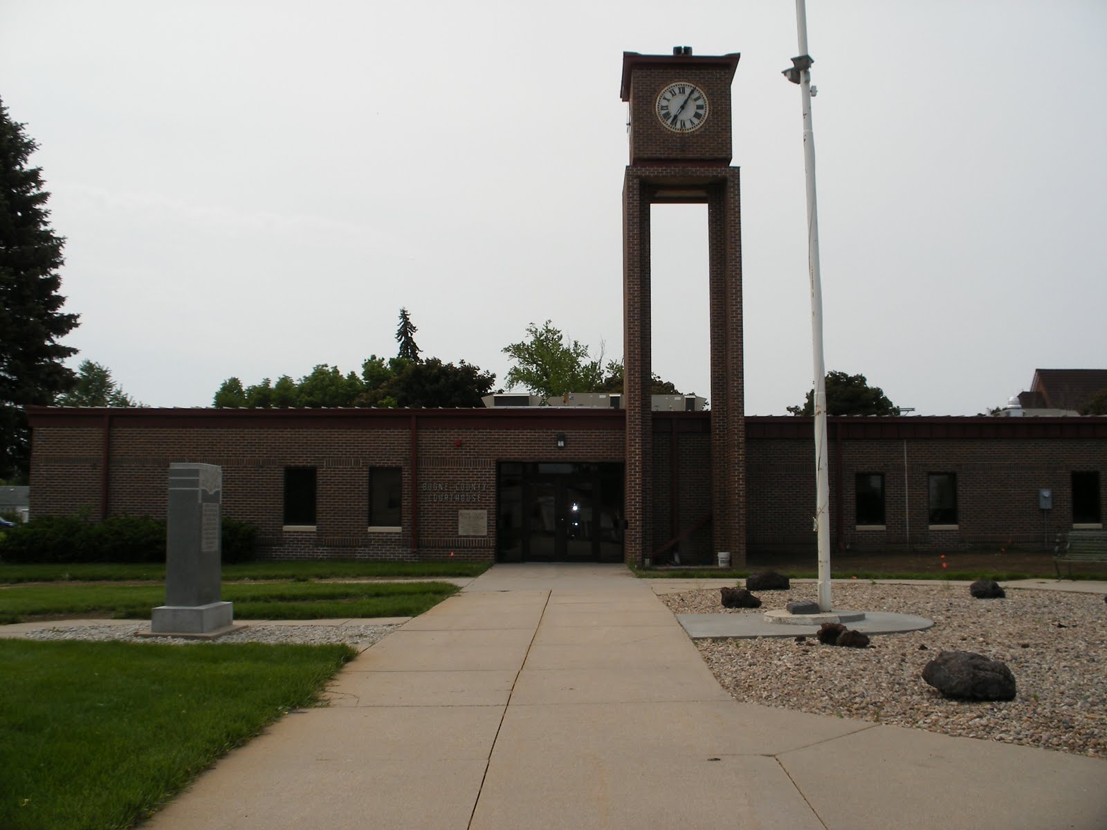 |
| Boone County Courthouse - Albion |
But in the late 1860s, Sam Smith of Columbus
Avery began the settlement just one month after the Legislature, on March 28, 1871, defined the boundaries and organized the county, naming it in honor of Kentucky Boone County
A difference of opinion arose over where the county seat should be located and a struggle developed between Albion and Boone, the only two locations with post offices. An election was held and Albion was the victor. Until the first courthouse was completed in 1897, commissioners met in an Albion hotel. The present courthouse was dedicated in 1976.
The community that today serves as the county seat actually had its name selected through a game of chance. Two factions argued for several weeks about what the town should be named. They agreed to settle the argument with game of euchre. Two men played for the name Albion; two for the name Manchester
Religion played a key role in the early development of Greeley County Wisconsin settled on the north side of the Loup River . Nine years later, the Irish Catholic Colonization Association was formed in Chicago for the purpose of relocating Irish immigrants to the healthy atmosphere in Nebraska Burlington
 |
| Greeley County Courthouse - Greeley |
A townsite called Scotia sprang up in the southwest corner of the county in 1874. Townspeople felt that their settlement was a better site for the county seat since the majority of county inhabitants were located in the Loup River Valley
That same year, a settlement called Greeley Center Greeley Center Greeley Center finally prevailed over Scotia in 1890. Since the post office was known simply as Greeley
Wheeler – 84 – Bartlett
On Feb. 17, 1877, the boundaries of Wheeler County
 |
| Wheeler County Courthouse - Bartlett |
Gov. Albinus Nance appointed a special board of commissioners and a county clerk who would be responsible for the organization efforts. At the time the county was being organized it included the area that is today neighboring Garfield County Cedar City Cedar City , so named because three large cedar trees stood there, was located approximately six miles north of the present town of Ericson
In 1881 residents in the western half of the county proposed their area should become a separate county and in November of that year Wheeler County
The question of where Wheeler County Bartlett Bartlett Bartlett
A modest courthouse was soon built in Bartlett
In 1976 the courthouse building was condemned by the State Fire Marshal. Concerned citizens began efforts to replace it. After more than six years of study, the present courthouse was completed in May 1982.
June 5
Antelope – 26 - Neligh
 |
| Antelope County Courthouse - Neligh, NE |
When it came time to select a name for a newly-created county in Northeast Nebraska , State Sen. Leander Gerrard recalled an incident that had occurred to him in this area the preceding year. In 1870 Gerrard was a member of a party that was in pursuit of thieves who had stolen livestock in the Columbus
 |
| The antelope on top is cool! |
In June 1871 the county was officially organized and 202 votes were cast in the first election. The present site of Oakdale was selected to serve as a temporary county seat.
John Neligh led a party up the Elkhorn River Valley Omaha Antelope County West Point became lost along the way. Neligh's message to the inhabitants of the county failed to arrive in time and Oakdale was subsequently victorious. A one-story frame courthouse was built the following year for $650. In 1874 it was destroyed by fire and residents decided at that time to move the county offices to a more central location. Neligh, the current county seat, was the overwhelming choice.
Early farmers in Antelope County
The Neligh community became widely known for Neligh Mills, built on the north bank of the Elkhorn River
Pierce – 40 – Pierce
 |
| Pierce County Courthouse - Pierce, NE |
The Ponca Indians, who lived along the Niobrara River Oklahoma Oklahoma , some of the Poncas would return to Nebraska and the Niobrara River Pierce County
The settlement of Willow Creek, the forerunner to Pierce, was established in 1870. The first house was a slab and sod structure that would serve as a post office, hotel and courthouse. When the county's first election was held on July 26 of that year, this settlement would be designated as the county seat and the name changed to Pierce.
Construction on the present courthouse began in 1974. The first wing, built directly west of the 1890 courthouse, was occupied a year later. In 1977 the original courthouse was demolished and construction began on the second wing, which would complete the courthouse two years later.
The entire cost of the new courthouse was financed and paid for through revenue sharing funds and courthouse and jail sinking funds. Upon completion, the courthouse was completely paid for without new local taxation.
Wayne – 27 – Wayne
An interesting part of Wayne County
 |
| Wayne County Courthouse - Wayne, NE |
In 1881 a movement was initiated to relocate the county seat to Wayne
Then came "An Eventful Day," as the Logan Valley Herald referred to July 4, 1884. That was the day a large celebration was held to honor the veterans of the Civil War. Around midnight the celebration came to an abrupt end when a fire alarm brought celebrants to the building that served as the county's courthouse. Apparently two men who had over-indulged in the celebration had been taken to the jail earlier in the evening. It was believed that somehow the two started a fire which destroyed the county's offices and records. Honoring its original obligation, the Wayne Town Hall Association quickly replaced the destroyed building with a frame courthouse on the same site.
Two years before the fire, Wayne County had received a donation of land within the townsite of Wayne Wayne County
JUNE 6
JUNE 6
Thurston – 55 – Pender
Almost a decade before Nebraska became a state, the federal government established a reservation for the Omaha Indian tribe in what today is Thurston County , as well as small portions of Dixon , Burt and Cuming Counties Omahas Thurston County
 |
| Thurston County Courthouse - Pender, NE |
The county's boundaries were established in 1855 by the Territorial Legislature. For a time the area was referred to as Blackbird County county Blackbird Nebraska
There is an interesting footnote regarding Chief Blackbird. One of his favorite campsites was located on a hill overlooking the Missouri River . According to Indian legend, when Chief Blackbird died his followers seated him on his horse and buried him at this site.
Federal government officials opened a portion of the Omaha Reservation to white settlers in 1884. The following year the area's first village was established. Buildings from the hamlet of Athens
With the passage of the railroads through Thurston County Nebraska 's only tri-county community, with sections actually platted in Thurston, Dixon
Dakota – 70 – Dakota City
Historical records of Dakota County officially begin in 1862 when the area was separated from Burt County Nebraska
 |
| Dakota County Courthouse - Dakota City, NE |
According to historical accounts, a fur trading post known as Fort Charles was established along the river in 1795, long before the area would become Dakota County Nebraska
Roughly 50 years before the first county boundaries were established, Meriwether Lewis and William Clark passed through the area during their journey up the Missouri River . At the time the area was primarily known only to members of the Dakota tribe.
The original county boundaries in this area of the state were actually created in 1855. The following year the Territorial Legislature named the Missouri River settlement of Dakota City St. John's challenging Dakota City St. John's and 263 for Dakota City Dakota City
Early settlers included William James, who in 1871 became Secretary of State, and John Taffe, who would later go on to serve in Congress.
The first courthouse was built in Dakota City South Sioux City was incorporated several miles to the north. In the years that followed, South Sioux City made several attempts to become the county seat but each time Dakota City
 |
| Dixon County Courthouse - Ponca, NE |
As the story goes, the waters of the Missouri River once undermined a large section of bluff along its south bank. As the bluff slid into the river, a chemical reaction occurred between the earth's minerals and the water and for days a column of fire, smoke and fumes rose toward the sky. As rumors began to circulate that a volcano had erupted, a steam-powered excursion boat from Sioux City
The original boundaries of Dixon County Dixon Nebraska
Members of the Ponca Indian tribe inhabited this area long before the first settlers arrived. That changed the year the county's boundaries were created, as a group of 11 Easterners settled along the creek banks that would eventually become the town of Ponca Indian territory , the settlers staked out claims and built sod shanties. In August of that same year, Frank West arrived from Sioux City
The county's original courthouse was built in 1883, 27 years after West founded Ponca. A three-story brick addition was added in 1938.
Cedar – 13 – Hartington
According to historians, three communities in Cedar County Randolph United States
 |
| Cedar County Courthouse - Hartington, NE |
The history of this area in Northeast Nebraska can be traced back to the 1650s when the Omaha Indians lived along the Bow Creek area. For the next 90 years this area that borders the Missouri River on the north was home to the Omaha
The Kansas-Nebraska Act of 1854 opened the territory to white settlers for the first time. Three years later Cedar County
Once covered by prairies grass, the county today is known for its farming and livestock production.
JUNE 7Knox – 12 – Center
The history of the area that today comprises Knox County can be traced back to the French explorers that passed through the area along the Missouri River in the late 1700s. When the county's boundaries were established by the Territorial Legislature in 1857, this French influence resulted in the area being named L'eau Qui Court, a French and Indian name meaning "running water," a reference to the Niobrara River
 |
| Knox County Courthouse - Center, NE |
When the county was first created, the settlement of Niobrara was designated as the county seat. Located on the far north boundary of the county, where the Niobrara River enters the Missouri River , the settlement was frequently flooded. But it would remain the county seat until 1902, after Center was platted.
This change of was met with considerable controversy. Between 1887 and 1900, five elections were held to determine if the county should be divided into two separate counties, and an additional five elections were held to select a county seat. Three of these elections came in 1900 alone.
Center was platted in the geographic center of the county in 1901 for the sole purpose of serving as the county seat. It was located on the site of two corn fields, with the fence that separated them becoming the settlement's main street. Within a year, the county's first courthouse was built.
Twenty-two years later, the County Board
In addition to county funds, the courthouse construction project was the first in the state to utilize Civil Works Administration and Federal Emergency Relief Administration funds. The make-work project for men on relief received considerable attention from the press, which said that the courthouse would remind the generations living long after the Great Depression of difficult times of that era.
Holt – 36 – O’Neill
Each year the residents of Holt County
 |
| Holt County Courthouse - O'Neill, NE |
The Irish heritage in the county dates back more than 122 years. Ten years after the county's boundaries were established in 1862, Gen. John O'Neill conceived a plan to bring his Irish countrymen out of the crowded East and to the land of "Room Enough." O'Neill traveled through Minnesota , Wisconsin , Iowa , Illinois , Missouri and Nebraska Holt County
The first attempts to organize Holt County Twin Lakes village of Paddock
Since Paddock was located on the extreme north edge of the county, dissatisfaction grew and a special election was held in 1879 to relocate the county seat to a more central location. O'Neill was chosen. It would not be until 1885 that a courthouse was built. Between 1888 and 1904 at least five attempts were made to move the seat of government again. All failed.
Today, O'Neill is known as the gateway to the Sandhills, with livestock feeders and farmers on the east and ranchers to the west. The area is one of the leading hay producers in the state. Because of the abundance of water sources in the county, irrigated corn is its most prevalent farm crop.
JUNE 8
Boyd – 63 – Butte
Situated between the Niobrara and Missouri Rivers Boyd County
 |
| Boyd County Courthouse |
In the early 1800s the majority of this area was part of the great Sioux Reservation, while a small portion of the land was a part of the Fort Randall Military Reservation. In 1889 a treaty was signed between the government and the Sioux which permitted the area to be thrown open for settlement. Historical accounts reveal that the Indians were at first reluctant to sign the treaty. When government officials arrived from Washington
Two years after the treaty was signed the county was established and named in honor of James E. Boyd, who was governor at the time the legislative bill organizing the county was approved. The settlement of Butte
It was not until 1895 that the state line between Nebraska and South Dakota
The county seat of Butte
Keya Paha – 82 - Springview
One of the most unique names among Nebraska 's 93 counties belongs to Keya Paha County Niobrara River
According to historians, the county's name is derived from the Dakota words Ké-ya Pa-há Wa Dakotas referred to the area, because numerous small, rounded hills make up the terrain.
 |
| Keya Paha County Courthouse |
Locating the county seat proved to be more difficult than creating the county. Nearly every settlement within the new county sought this important distinction. A committee was appointed to make a selection. But failing to accomplish this, the issue was put to a vote when the county's first election was held in January 1885. Fifteen different settlements were listed on the ballot. The field was pared to two and the newly-elected county officers ordered another election for March 24.
When election day arrived, voters were asked to choose either Burton
Springview included 160 acres of choice land and a natural spring, for which the settlement had been named. Lots in the county seat were sold for $20 each. Building activity began almost immediately after the election. Until enough lots were sold to accumulate the necessary funds to build a courthouse, county offices were housed in a private residence.
Cherry – 66 – Valentine
There are many attributes which make Cherry County unique, not only among the counties in Nebraska
 |
| Cherry County Courthouse - Valentine |
First, of course, is the county's size. With 6,048 square miles, Cherry County is by far the largest in total land area of all Nebraska Nebraska
Also unique to Cherry County Snake River Falls ranks as the largest in Nebraska , while Smith Falls Shlegal Creek Falls
Finally, the county seat of Valentine makes the news reports each February 14 when literally thousands of cards and letters from across the United States
The first settlement in this area can be traced to 1878 when the government located about 5,000 Sioux Indians on the Rosebud Reservation, which borders Cherry County on the north in South Dakota Niobrara River Fort Niobrara
The county's first courthouse was an abandoned military building brought into Valentine from Wisconsin
Today, this Sandhills county is often referred to the "Heart of Cattle Country," "Home of a Million Cattle," and "God's Own Cow Country."
JUNE 10
Blaine Blaine County
JUNE 10
Brown – 75 – Ainsworth
It is quite possible that no one will ever know for exactly whom Brown County
Considered part of the Sandhills, Brown County was at one time part of an area known as Sioux County Holt County was organized and for taxation purposes the area that would become Brown County
 |
| Brown County Courthouse - Ainsworth |
Early settlements of the mid-1870s were cattle ranches, stocked with Texas longhorns that had been driven over the old Chisholm Trail . Rich prairie grass, ample water and firewood, and sufficient shelter in the canyons made the area perfect for raising cattle herds. But the area had yet to be officially opened for settlement and these ranchers had no legal title to the land. The severe winter of 1880-1881 resulted in the starvation of scores of cattle herds and many of the ranchers were forced to abandon their dreams. This meant the land was open for settlement again.
Covered wagons and the westward advancement of the Fremont , Elkhorn
Ainsworth was named the county seat in July 1883 election. The county's original courthouse was constructed in 1887 and used until it was destroyed by fire on Easter morning in 1958. County offices were temporarily housed in buildings along the main street of Ainsworth until February 1961 when the present courthouse was opened.
Rock – 81 – Bassett
The area known today as Rock County was once attached to Holt County Brown County Brown County Rock County
There are two versions of how the county received its name. The first is that it was named after Rock Creek, which empties into the Niobrara River
 |
| Rock County Courthouse - Bassett |
When it came time to select a county seat, five locations vied for the honor -- Bassett, Newport , Rock Center , Thurman and Tracy Newport
At a special election on Nov. 8, 1889, a $5,000 bond was approved by Bassett voters to build a frame courthouse. When the courthouse was destroyed by fire 10 years later, the conflict between the two townsites resumed. Bassett quickly built another courthouse, which served the county until 1940. It was during that year, with the assistance of the Public Works Administration, and the current courthouse was built in Bassett.
When the area was first being settled, small farms and ranches were commonplace. Ranching remains the economic mainstay today, with the county being recognized as one of the top producers of wild hay in the state. With the development of center pivot irrigation systems, Rock County
The early 1800s brought a handful of the first homesteaders to this area of the Sandhills. But their dreams quickly faded as they soon discovered the soil in this region was not conducive to dryland farming. With the light soil and lack of rainfall, they packed up and headed for areas better suited to raise crops.
A year before the Legislature defined the boundaries of Blaine County , George Washington Brewster came to the area and homesteaded along the North Loup River . It was 1884 and Brewster invested a small fortune of his personal wealth to build a town and construct a bridge across the river. From this new town he began The Brewster News. Within two years, two additional newspapers -- The Ladora Independent and The Blaine County Democrat -- also were being published. Today, however, the county is without a newspaper.
 |
| Blaine County Courthouse - Brewster |
When the county was created by the Legislature on March 5, 1885, it was named in honor of American statesman James G. Blaine. In November of the following year the first election was held and Ladora was named as the county seat. In the general election of 1887, Brewster became the county seat and two years later a courthouse was built. That building served the citizens for 18 years before burning to the ground in 1907. The following year a new courthouse structure was built and the same building serves the citizens today. Between 1967 and 1976, an addition was made to the building and the courthouse interior was completely remodeled.
The land of Blaine Nebraska National Forest
JUNE 11
JUNE 11
Loup – 88 – Taylor
Loup County may very well be the only county in Nebraska that can make the claim that local tax dollars were not used for the construction of the county's first courthouse.
When Loup County was officially organized on Feb. 23, 1883, a local rancher wanted to see the county seat remain in Taylor. He decided the best way to ensure this was to erect and donate a building to the county that could be used as a courthouse. The following year, a two-story, four-room building was completed and would serve as the courthouse for the next 74 years.
 | |
| Loup County Courthouse - Taylor |
Loup County was originally created in 1855 and included land as far east as the present day Colfax County. The county received its name from the Loup River, which cuts across the southwest corner of the present county. In the northeast sector of this Sandhills County is the Calamus River, which empties into the Calamus Reservoir, the state's third largest lake located about 15 miles northeast of Taylor.
Before Taylor would become the official county seat, a fierce struggle developed between Taylor and the settlements of Kent, Almeria and Clarke's Point. In a special election conducted in May 1883, Taylor was chosen over Almeria by a mere two votes.
Several famous names in Nebraska history have a link to Loup County. First, Amos Harris, said to be Nebraska's first black cowboy, and his wife, Eliza, at one time ranged cattle in the North Loup Valley. It is also said that "Doc" Middleton and "Kid" Wade, notorious cattle and horse rustlers, operated out of the Loup County area in its earliest days.
Garfield – 83 – Burwell
Garfield County lies at the gateway to the Nebraska Sandhills. Although the very southern portion of the county is part of the rolling plains where farming flourishes, the majority of Garfield County is considered part of the Sandhills region and ranching is the economic mainstay.
 |
| Garfield County Courthouse - Burwell |
A settlement known as Willow Springs became the original county seat by virtue of the county's first election. But as the 1880s progressed, the Burlington and Missouri River Railroad pushed through the county and headed toward Burwell. This spelled the demise of Willow Springs and in February 1890 county residents overwhelmingly voted to make Burwell the permanent county seat.
Garfield County's first courthouse opened in Burwell 10 months later. The wooden two-story building would be used for the next 73 years. In the 1962 primary election it was decided on a 672 to 276 vote that the county was in need of a new courthouse. Bonds were issued in the amount of $140,000 to build a modern one-story structure. On Sept. 1 construction began and on April 1, 1963, the county offices moved into their new home. The following Nov. 11, in conjunction with Veterans Day, the county formally dedicated its new courthouse. Delivering the dedication address that was U.S. Sen. Roman Hruska, who 12 year earlier had served as president of the Nebraska Association of County Officials while a member of the Douglas County Board of Commissioners.
In the early days Garfield County boasted as many as nine townsites. A look at a 1994 state map reveals that only one of those remains -- that being the county seat of Burwell.
Valley – 47 – Ord
Valley County derives its name from the land conditions that exist in the area. Located between the North and Middle Loup Rivers, the terrain is mostly prime valley land which lies between the higher table lands.
 |
| Valley County Courthouse - Ord |
The first settlers in this area are said to have been two distinct groups who had traveled from Wisconsin in 1872. The first was a small party of Danes who settled on the west side of the North Loup River near the present site of Ord. The second group of settlers consisted of a colony of Seventh-Day Baptists who homesteaded farther downstream near the present day town of North Loup. Their objective was to settle on the frontier in order that they might remain undisturbed by those who observed the first day of the week as the Sabbath.
Throughout the early years there were persistent rumors that Indian raids were about to occur in the county. Gen. Ord decided to station a company of soldiers in the northern part of the county just in case. Although there were some minor skirmishes and one that resulted in the death of one of Gen. Ord's soldiers, for the most part they were just rumors.
In 1884 the settlers of Valley County were looking forward to a large yield from their crops. That quickly changed when a wave of grasshoppers covered the state and completely destroyed every living plant in its path. Losing the crops they had counted on to survive the coming winter, many of the settlers left the area, never to return.
Sherman – 56 – Loup City
The origins of Sherman County are said to have begun with a group of men who lived in Grand Island in the early 1870s. These men organized a settlement plan for the Middle Loup River Valley and secured the necessary authority from Gov. Robert Furnas and the Legislature to proceed in early 1873. When the county was formally organized it was named after Civil War hero Gen. William Tecumseh Sherman, who once commanded cavalry troops in Nebraska.
 |
| Sherman County Courthouse - Loup City |
 In the county's first official election, held on April 1, 1873, a mere 13 votes were cast. Elected to office were three commissioners, a clerk, judge, treasurer, sheriff, surveyor, coroner and superintendent of public instruction. By the following year the county had its first courthouse, built at a cost of $5,000. But on the same day commissioners accepted a bid to furnish the building, it was destroyed by fire. It would be four years before the structure to be replaced.
The Loup River, which cuts across the county diagonally, was responsible for attracting many of the area's first settlers. The fertile valley soil and the plentiful supply of water made the area a prime location for early farmers. Irrigation further enhanced the county's farm economy when it made its first appearance in 1895. This early irrigation system consisted of a ditch being dug between Arcadia and Loup City and water being diverted from the Loup River.
Irrigation would once again become an important part of the county's history in 1932 when the Middle Loup Power and Irrigation Company was created and in 1959 when work began on the Sherman Dam and Reservoir.
The courthouse that was built in Loup City in 1878 would be outgrown by the county as the 1900s began. Efforts would begin to replace the existing building with a courthouse that could accommodate all county offices and the expanding volume of records. Construction began in 1920 on what is the present courthouse. The tan brick building with terra cotta trim was formally dedicated on Oct. 8, 1921.
Custer – 4 – Broken Bow
Located in the geographic heart of the state, Custer County features a diverse blend of topography. Nearly three-quarters of the county is in the state's corn belt, while the northwest one-quarter is considered part of the Sandhills. Consequently, corn and cattle production are the dominant contributors to the county's present day economy.
 |
| Custer County Courthouse - Broken Bow |
Only a handful of settlers came to the area in the years leading up to the 1870s. Since the region was virtually uninhabited, these settlers were able to amass enormous ranches. Eventually, more and more homesteaders came to the area, fenced in their land, and planted crops. With the tremendous cattle losses during the winter of 1880-81, the ranchers gave way to thousands of homesteaders coming to the area after the Civil War. Sod houses and small settlements quickly began to replace the vast ranches.
The first courthouse was a cedar log, two-room, L-shaped structure that was built in 1876 on the Young Ranch near the South Loup River. It was used from the time the county was organized in 1877 until Broken Bow was named the county seat after a special three-way election.
People often inquire how the county seat received its unique name. According to historians, Wilson Hewitt was postmaster for the area at the time and had suggested three names. Shortly after the third was rejected, Hewitt's two sons showed him a broken Indian bow they had found on the banks of nearby Muddy Creek. Hewitt suggested Broken Bow and it was quickly accepted by the post office department.
A red brick, ornate courthouse with rounded towers on the corners was build in 1889. It was destroyed by fire in 1910. Two years later, the county's present courthouse was constructed on the same site.
Lincoln – 15 – North Platte
On Jan. 7, 1860 the Territorial Legislature approved the boundaries of Shorter County, the forerunner to Lincoln County. In those days this area was the site of considerable hostilities between the Sioux and Cheyenne Indians and the federal government moved in troops to provide protection for the growing number of settlements along the Platte River Valley.
To accommodate the troops, Fort McPherson was built near Cottonwood Canyon in 1863. In addition to controlling Indian tensions, the soldiers stationed here also were assigned to protect dignitary hunting parties that would occasionally come to the area. Buffalo Bill Cody, a name deeply embedded in the history of this area, served as scout and guide for many of these hunters.
 |
| Lincoln County Courthouse - North Platte |
Another name long associated with Lincoln County is that of the Union Pacific Railroad. As the railroad pushed west in the 1860s, North Platte developed into one of the prominent railroad towns along the route. It maintains that status today. The railroad's early influence contributed immensely to the development of the county. Evidence of this can be seen in the following excerpts from one of the company's advertisements:
"Union Pacific Railroad ... has land grants direct from the government ... 1,500,000 acres of choice farming lands on the line of the road ... in the Great Platte Valley. Now for sale for cash or credit at low rates of interest. Convenient to markets both east and west. Prices range from $2.50 to $10.00 per acre."
In 1867 the county seat was moved from Cottonwood Springs to North Platte. The county's first courthouse was built in 1874. After the turn of the century plans began being made for the present courthouse, which was completed in 1920.
JUNE 13
Logan – 87 – Stapleton
The boundaries of Logan County were established by the Legislature on Feb. 24, 1885. But it would not be until 45 years to that day that Stapleton would become the county seat.
 |
| Logan County Courthouse - Stapleton |
When the Union Pacific Railroad began work in 1911 on a branch line that would run through Logan County, a townsite company was chosen to locate towns along the new route. Gandy was bypassed and instead a town named Stapleton was laid out at the railroad's terminus. Stapleton was located just 3½ miles west of Gandy. As Stapleton began serving a large trade area, two banks, a drug store and several other businesses relocated from Gandy to the rapidly developing new town.
The residents of Stapleton began to promote their town to become the county seat. It took 18 years before a special election was held on May 2, 1929, and their dream became reality. After a court challenge, Stapleton finally became the county seat on Feb. 24, 1930.
Logan County, located on the southern fringe of the Sandhills, is named in honor of Gen. John A. Logan. Many of its early settlers were Civil War veterans who would develop the county with ranches and farms, the same industries that support the area today.
Thomas – 89 – Thedford
Thomas County's early development can be tied directly to the westward advancement of the railroad. As a result, the county's early history dates back only to the 1880s.
The first homestead claim in this area was filed in 1880. It would be seven years later before the Nebraska Legislature would create the county's boundaries and name the area after Civil War Gen. George H. Thomas.
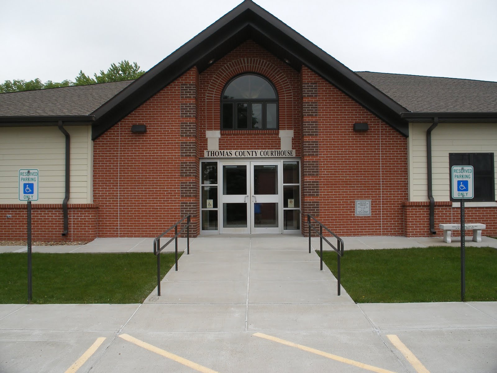 |
| Thomas County Courthouse - Thedford |
But it was the railroad which played the most prominent role in the county's development as it followed the Loup River. By the mid to late 1880s the Chicago, Burlington and Quincy line stretched from the county's east to west boundaries. Along the route the railroad designated five stations: Norway, Natick, Halsey, Thedford and Seneca. The latter three eventually became the county's only settlements.
Thedford was designated as the county seat when the county was organized. In 1887, the year the railroad line reached the settlement, a post office opened. About the same time the county's first courthouse was built. It would be replaced in 1922 by the present courthouse.
Passage of the Kinkaid Act in 1904 had a big impact on Thomas County. In the 1890 census, only 517 residents were reported. With the Kinkaid Act many new settlers came to the area in hopes of farming the 640 acres of land they received. The county's all-time high population of 1,773 residents was recorded in 1920. But since the region was not conducive to farming, many of these "Kinkaiders" left the area by 1930. Those who remained bought the abandoned homesteads and created large ranches. In 1940, 14 ranches were said to contain nearly 3,500 acres each.
In addition to large cattle ranches, Thomas County is also home to the Nebraska National Forest located between the Loup and Dismal Rivers.
(NOTE: Thomas County built and dedicated a new courthouse in 2006.)
(NOTE: Thomas County built and dedicated a new courthouse in 2006.)
Hooker – 93 – Mullen
Despite the fact the Middle Loup and the Dismal Rivers cross what today is Hooker County, for many years the area was not as well suited as other counties in the Sandhills for farming or livestock grazing. This led to the county developing at a much slower place than some of its neighbors.
For many years the area was a hunting ground for the Sioux Indians and home to buffalo and other wildlife that roamed the rolling hills and deep valleys. The area remained government controlled land and was not open for settlement.
 |
| Hooker County Courthouse - Mullen |
In 1877 the Grand Island and Wyoming line of the Burlington Railroad advanced from Broken Bow to near Whitman in neighboring Grant County. Since the railroad was having difficulty obtaining the land it wanted near the trading post for a switching yard, crews laid a switch siding about a mile to the east. A boxcar was used as a depot and it was named Mullen, in honor of one of the contractors building the rail line.
Eleven years later, Amos Gandy and George Trefren purchased land near the depot and laid out the townsite of Mullen. They designated one block of the original town to be used for a courthouse once the county was formed. That would occur the following year when the Legislature established the boundaries for a new county to be named Hooker, in honor of Civil War Gen. Joseph Hooker. During that year the first election was held, county officers conducted their first meetings, taxes were levied, and bonds were sold in the amount of $1,521 for the construction of a courthouse and jail. The two-room structure was completed by the following November.
By 1920 Hooker County reached a peak population of 1,300 and three years later a larger brick courthouse was built.
JUNE 14
McPherson – 90 – Tryon
Although the original boundaries of McPherson County
 |
| McPherson County Courthouse - Tryon |
Passage of the Kinkaid Act in 1904 is credited with an increase in the number of settlers who came to McPherson County
Tryon, the McPherson County seat, is one of only two unincorporated villages in Nebraska Harrisburg , in Banner County
Arthur – 91 – Arthur
 |
| Arthur County Courthouse - Arthur |
With the Kinkaid Act of 1904, the area began to be settled at a more rapid pace. The increase in the number of residents and in tax revenues quickly put schools and local government on a more solid financial foundation. This southern Sandhills region grew from 517 inhabitants in 1900 to nearly 2,500 by 1910.
It became clear to the inhabitants of the area that separate counties and separate county seats were needed. A letter appearing in the March 13, 1913 edition of the Hustler, Arthur County 's first legal publication, noted "For the number of people and to dispense justice and liberty, would it not be best to make two counties and let Arthur County
State lawmakers were in agreement and during the 1912-1913 session of the Legislature passed a second enabling act authorizing Arthur County
Grant – 92 – Hyannis
In the years that immediately preceded the establishment of what today is Grant County, this area in the heart of the Nebraska Sandhills became knows as a favorite hiding place for outlaws and other fugitives from justice due to the wide open, sparsely settled terrain and the lack of local government authority.
 |
| Grant County Courthouse - Hyannis |
The Kinkaid Act of 1904 is said to have brought an end to the days of free and open range, as new settlers hoped to establish farms on their claims. These farmers quickly became disheartened as winds blew away the tilled soil and crops failed. They sold their claims to area cattle ranchers.
According to state statistics, less than a decade ago Grant County had a larger number of cattle per square mile than any other county in the United States Hereford cattle breed to this county is even depicted with a mosaic picture that is mounted on the side of the courthouse in Hyannis
JUNE 15
Box
Located in the heart of the Nebraska Panhandle, Box Butte County is one of only two Nebraska Alliance
 |
| Box Butte County Courthouse - Alliance |
Originally part of Dawes County , Box Butte County Hemingford Alliance Alliance
The railroad industry continues to play an important role in the county's economy today. However, of equal or greater significance is agriculture. More than 23,000 acres of crop land and meadows flourish in the county today. Principal crops include winter wheat, corn, sugar beets, beans, potatoes and sorghum. The county is also known for its livestock production. The Great Plains soil, combined with the ample rainfall the area normally receives during the April 1 to Oct. 1 growing season, makes Box Butte County one of Nebraska
JUNE 16
Sheridan – 61 – Rushville
Sheridan – 61 – Rushville
The first white settlement in what would become Sheridan County
 |
| Sheridan County Courthouse - Rushville |
In February 1885 the Legislature established the boundaries for three new counties in Northwest Nebraska -- Sioux, Dawes and Sheridan. In July of that same year, Gov. James W. Dawes proclaimed the counties' formal creation, with Sheridan County being named in honor of Civil War Gen. Philip H. Sheridan, who had once lead cavalry troops against Indian raids in the Nebraska Territory
At the time Sheridan County
During those early development years, an impassioned contest took place for the county seat. Rushville was joined by Gordon, Hay Springs and Clinton
Dawes – 69 – Chadron
Dawes – 69 – Chadron
 |
| Dawes County Courthouse - Chadron |
Since the lands were unsurveyed and belonged to the public domain, the unwritten law of the land at the time was the first to establish a ranch on a certain creek or in a certain locale was entitled to sufficient range for his needs. The "range" boundaries were well defined and no one encroached upon the rights of his neighbor. Small ranches would have 500 head of cattle, while others were as large as 2,000 to 5,000 head. While the unwritten law of the land worked well, these ranchers had no legal rights to the land.
In 1882, the cattlemen received word that two railroads were going to extend their lines through the territory and that the government was about to survey the area with the intent of opening the lands for legal entry and settlement. With a new era on the horizon, open range ranching began to give way to the grain farming of the new homesteaders. By 1885, the cowboy era had virtually come to an end.
JUNE 17
Sioux – 80 – Harrison
Once known as Beauvais Terras, or badlands, it would take nearly 20 years after Nebraska was admitted to the Union before action would be taken to organize this northwest region of the state. In fact, for many years the area known as Sioux County actually consisted of what today are 13 separate counties, stretching from Holt County westward to Wyoming
 |
| Sioux County Courthouse - Harrison |
The boundaries for the initial Sioux County
With the railroad passing through the county the following year, a tent town known as Bowen sprang up along the line. Years later it would become known as Harrison and the site of the county seat. Five sites vied to become the county seat and several interesting stories resulted. Bowen and Bodarc, located 12 miles to the northwest, were the principal contenders. Others were Andrews, Montrose and the S-E Ranch.
When the election was conducted in January 1887, an old-time cowboy was assigned to take Bodarc ballots to a polling site 50 miles away. He stopped for the night in Bowen, where townspeople kept him at the card table with ample liquor. The following morning he was handed another bottle and sent on his way. He arrived at the polling site to discover his Bodarc ballots had been replaced by Bowen ballots. Bowen easily won.
When it came time for a $10,000 bond issue election to build a courthouse, a similar incident occurred. Before the ballots could be counted, several men allegedly switched ballot boxes and the bond issue won easily.
The first courthouse was built in 1888 and stood for 42 years. In 1930 the present courthouse was constructed.
Scotts Bluff – 21 – Gering
 |
| Scotts Bluff County Courthouse - Gering |
The Oregon Trail , Mormon Trail and Pony Express Route brought early travelers and settlers to the area. But it was actually the railroads which spurred the greatest growth. The Chicago , Burlington and Quincy North Platte River , this fact resulted in Scottsbluff growing at a faster pace. Today, Scottsbluff and Gering combine to serve as a central retail hub for a 150-mile radius.
The lush North Platte River Valley
JUNE 18
Morrill – 64 – Bridgeport
 |
| Morrill County Courthouse - Bridgeport |
A special election was called for Nov. 3, 1908 , and the proposal was approved by the local electorate. Nine days later a proclamation officially creating Morrill County
Like many other counties, the 1904 passage of Kinkaid Act attracted many new settlers to the area. These settlers found the high table lands bordering the North Platte River Valley
In the years that immediately preceded the official organization of Morrill County Alliance Guernsey , Wyo. North Platte
One of these townsites to benefit from the railroad was Bridgeport
Banner – 85 – Harrisburg
 |
| Banner County Courthouse - Harrisburg |
The area that today makes up Banner County Cheyenne County Nov. 6, 1888 , Banner, Kimball and Scotts Bluff Counties Cheyenne County
Kimball – 71 – Kimball
An election held Nov. 6, 1888 resulted in the western third of Cheyenne County Scotts Bluff Counties Kimball County
As the railroad passed through this area in the 1860s, a settlement named Antelopeville sprang up. It was named as such because of the prevalence of antelope in the area. When attempts were made to recognize a post office as Antelope, it was discovered there was already a post office in the state by that name. So in 1885 the name of the townsite was changed to Kimball and it became the county seat.  |
| Kimball County Courthouse - Kimball |
Another title worn by Kimball County Nebraska
In addition to the railroad, the Kincaid Act of 1904 was credited with bringing many settlers to the area, primarily farmers. The native buffalo and gramma grass made cattle feeding a natural for the Kimball County
JUNE 19
Cheyenne – 39 –
The development of Cheyenne County can be attributed to early America Oregon
Although the two famous trails actually flanked the area that today is Cheyenne County , many early pioneers followed Lodgepole Creek from Julesburg , Colo. , to the site of present day Sidney Lodgepole Creek route.
 |
| Cheyenne County Courthouse - Sidney |
In 1867, when the Union Pacific pushed toward the Wyoming Sidney
With heavy traffic along the trails and on the railroad, Sidney Fort Sidney Sidney
Today, America
Deuel – 78 – Chappell
The area of Deuel County
 |
| Deuel County Courthouse - Chappell |
The county seat of Chappell possesses an interesting history. Charles Henry Chappell, an Illinois Omaha
Becoming the county seat was not an easy task. When the county was organized, a three-way fight involving Big Springs, Chappell and Froid developed. A special election was held in February 1889. Chappell precinct had 275 legal voters, while Big Springs had 200 legal voters. When the election was completed, Chappell precinct reported a 3,210 to seven victory. Big Springs claimed it had won by a 5,616 to 87 vote. The honesty of Froid was demonstrated when it show a tally of just 292 votes.
Charges of illegal voting were made by both Chappell and Big Springs. A judge ordered county offices to remain in Chappell. It would not be until April 1894 that Judge Silas A. Holcombe rendered a decision. Since the ballots and election records had been stolen, the court could not make a determination as to the victor and ordered a new election. It took two elections that year before a majority vote was cast and Chappell was the winner.
The present courthouse was constructed in 1915 and is located on the same site as the first small structure that was used during the county's stormy organizational days.
Garden – 77 – Oshkosh
Garden County was established in 1909 after a successful election effort to create a new county from the northern portion of existing Deuel County Oshkosh Oshkosh itself, the county seat, dates back to 1886 when a group of settlers formed the Oshkosh Land Oshkosh , Wis.
 |
| Garden County Courthouse - Oshkosh |
Much of Garden County Nebraska Montana
On the eastern boundary of the county lies Ash Hollow, which was the scene of many dramatic and significant incidents in local history. Ash Hollow was the converging point of the Mormon Trail and two branches of the Oregon Trail . The area may be most famous for the 1855 battle between the Army cavalry and a band of Brule, Ogalala and Minneconjoe Sioux. After the battle, Gen. Harney erected a small post at the site to support the immigrant wagon trains and to furnish escorts for the monthly mail deliveries between Forts Kearny and Laramie
Today, northern Garden County is one of Nebraska 's leading cattle ranching areas, while the North Platte River Valley
Keith – 68 – Ogallala
 |
| Keith County Courthouse - Ogallala |
The Oregon , Overland South Platte Rivers
When organized on May 3, 1873, Keith County was named in honor of M.C. Keith of North Platte , who owned one of the largest ranches at that time in Western Nebraska . He was also the grandfather of Keith Neville, governor of Nebraska
When the railroad passed through the area in the 1860s, the famous Texas-Ogallala Trail was forged to bring longhorn cattle to the shipping yards in Ogallala. From there they were transported to Midwestern markets or to Wyoming and Montana Texas
The Kingsley Dam on the North Platte River was constructed after the turn of the century to provide irrigation water for farmers in the central part of the state and hydro-electric power. For many years it was the world's second largest earthen dam. The lake that resulted, affectionately known as "Big Mac," is 25 miles long, has a shore line of about 100 miles, and provides a variety of recreational activities for tens of thousands of people each year.
JUNE 20
Perkins – 74 – Grant
For many years, Perkins County was part of Keith County Keith County
The lands north of the Platte River Platte River petitioned Keith County
 |
| Perkins County Courthouse - Grant |
There are two versions of how the county was named. The first claims it was named after Charles E. Perkins, who was president of the Chicago , Burlington
The first order of business for the new county was to establish a county seat. Knowing the financial benefits associated with being the county seat, the townsites of Grant , Madrid and Lisbon
Grant had been established two years earlier. It began with a store and a newspaper. On July 4 of the following year, a major celebration took place when a Chicago , Burlington and Quincy
At the beginning of the 20th century, Perkins County
Chase – 72 – Imperial
It was once said that excluding ranch owners, their wives and their cooks, at the time Chase County Frenchman River , which traverses the county, was used as a watering stop for cattle drives that traveled from Texas
 |
| Chase County Courthouse - Imperial |
But being situated on the broad, fertile plateau once referred to as the "Great American Desert ," early settlers quickly discovered Chase County
The organization of Chase County Hayes County Omaha for seven years and was Nebraska
A Canadian emigrant, Thomas Mercier, settled on the site that would eventually become the county seat of Imperial. It is said that Mercier laid out the town and gave it its name, presumably after the British Imperial government.
Several towns within the county competed to become the county seat. It took three elections before any town received a majority of the votes. That town was Imperial and in 1889 the first courthouse was built. For more than 20 years the courthouse was the social center of the community. The building was home to church services, school programs and social balls, in addition to housing the local government offices. But in 1910 the building was destroyed by fire. The following year a new brick and cement courthouse replaced it. That building is still in use today.
Dundy – 76 – Benkelman
Wild, untamed country. That is how the area that would become Dundy County Dundy County
 |
| Dundy County Courthouse - Benkelman |
At the close of the Civil War, Texas Southwest Nebraska area provided cattlemen vast open range lands free for the taking.
With the coming of the railroad, a settlement named Collinsville Collinsville would be renamed Benkelman, in honor of a family that owned large cattle ranches in Kansas and Colorado Denver
The days of longhorns, cowboys and saloons would give way to homesteaders, who sought the free land for homes and a better way of life. What would follow were bitter range disputes between the cattlemen and the homesteaders. But the Homestead Act and a Nebraska embargo placed on Texas
In 1888, the settlements of Hiawatha, Ough and Allston waged stiff competition with Benkelman to become the county seat. Benkelman chose not to enter the controversy and quietly built a courthouse. County commissioners then designated Benkelman as the county seat. A second courthouse replaced the original on the same site 30 years later.
JUNE 21
Hitchcock – 67 – Trenton
In the late 1860s and early 1870s an influx of cattlemen began moving into the area between the Republic and Frenchman River Valleys in Southwest Nebraska. By the spring of 1873 the population had increased so dramatically in this area that settlers sent a petition to Gov. Robert B. Furnas requesting that a county be organized.
 |
| Hitchcock County Courthouse - Trenton |
Early development of what is today Hitchcock County can be traced back to the days of the Texas-Ogallala Cattle Trail, which cut across the area diagonally. Years later the Burlington and Missouri River Railroad would have an even greater impact.
The summer of 1874 took its toll on the county, as a drought and an infestation of grasshoppers forced many settlers to pack up and move on. Eventually the county began to recover and in the early 1880s a series of townsites sprang up. One of these was Trenton, which was established near the center of the county in 1884 by the Lincoln Land Company. Trenton, located on the Republican River, would be named the county seat in 1894 and in 1906 the first courthouse was built. This building would house the county's offices until 1969 when the present courthouse was constructed.
With its dependence on agriculture, Hitchcock County realized early on the importance of conservation, flood control and irrigation. This led to the construction of a large dam on the Republican River just west of Trenton. In 1949, state and local officials dedicated the Swanson Reservoir. Today the large lake, named in honor of Trenton conservationist and civic leader Carl Swanson, is a popular recreation area.
Hayes – 79 – Hayes Center
Hayes County was created by an act of the Legislature on Feb. 19, 1877 and named for President Rutherford B. Hayes. It was not until the latter part of 1884, however, that the county officially organized. The following year, Hayes Center was founded with the intent of it being the county seat.
 |
| Hayes County Courthouse - Hayes Center |
In October 1871, President Ulysses S. Grant revealed that Grand Duke Alexis of Russia would be making a tour of the United States. One of the Duke's desires was to shoot a buffalo during his visit. Arrangements were quickly made for the Duke and his party to hunt on the central plains in the Nebraska Territory. Leading the hunt would be Gen. George Custer and Gen. Phil Sheridan. Buffalo Bill Cody, at age 25, would serve as the guide.
Cody asked Sioux Chief Spotted Tail to help round up a buffalo herd. In exchange for his assistance, Spotted Tail would receive 1,000 pounds of tobacco.
An elaborate camp was set up one mile west of Red Willow Creek, just inside what today is the eastern boundary of the county. It included two hospital tents for royal meals, ten wall tents for guests and generals, and a dormitory tent for orderlies and Russian servants.
The hunt took place in January 1872. The scouts and the Sioux found a herd of buffalo near Medicine Creek. After Duke Alexis emptied two pistols, Cody gave him a .50 caliber Springfield rifle. On his first shot, the Duke dropped a buffalo bull. Russian servants immediately brought out a basket of champagne to celebrate. Before the hunt ended, the Duke shot a total of eight buffalo.
Red Willow – 48 – McCook
Red Willow County received its name from Red Willow Creek, which runs through this area of Southwest Nebraska. It has been reported, however, that the name is actually a mistranslation of the Dakota Indian name "Chanshasha Wakpala," which literally means Red Dogwood Creek. The Dakotans referred to the creek as such because of an abundance of the red dogwood shrub that grew along the creek banks.
Before this area would become a county, an exploration company was formed in Nebraska City for the express purpose of establishing a settlement somewhere in the Republican River Valley. In 1871 the party decided on an area at the mouth of the Red Willow Creek. A surveyor was hired to lay out a town patterned after Lincoln, with large, wide streets.
 |
| Red Willow County Courthouse - McCook |
The county was officially organized in 1873. That same year the town of Indianola was laid out along Coon Creek. Indianola and Red Willow each wanted to secure the greatest number of settlers and become the county seat. Following an aggressive campaign, the Indianola ticket was victorious over the Red Willow ticket.
The election results were quickly contested by Red Willow supporters and the case went before a justice of the peace in neighboring Furnas County. Indianola supporters would not recognize the justice's authority and refused to appear. The justice declared the election was illegal and Red Willow immediately sought control of the county. Red Willow supporters went to Indianola and took the county records and county seal by force. Tempers eventually subsided and the records were returned to Indianola, which remained the county seat until it was moved to McCook in 1896.
The residents of McCook constructed a courthouse that was "sufficient in all respects at the time for the demands of the county." Continued growth and development in the area forced the county to raze the building in 1926 and construct the current courthouse. In 1990 an extensive remodeling project was set into motion and the building was rededicated by county officials last year.
JUNE 23
Frontier – 60 – Stockville
 |
| Frontier County Courthouse - Stockville |
When Frontier County Nebraska
Henry and Mortimer Clifford were two of the early cattlemen to live in the area and their efforts are greatly credited for the organization the county. The Clifford brothers had come to the area, married Indian women, and decided to settle along Medicine Creek where they could raise cattle. The site of the Cliffords' settlement was not too far from where the present town of Stockville
Two years before the county was officially established, cattlemen came to know the W.L. McClary ranch as the place where information could be exchanged or left for those who passed back and forth through the area. This site was located near the geographic center of the county and would be the forerunner to the settlement that would become known as Stockville, the county seat.
Stockville is not only in the geographic center of the county, it also has been the center of considerable controversy over the years.
Among the towns that were settled in the county was Curtis, located along Curtis Creek
Today, the courthouse that was built in 1888 is the prominent feature of Stockville's main street.
Gosper – 73 – Elwood
Between 1873 and 1889, three different county seats served the inhabitants of Gosper County
 |
| Gosper County Courthouse - Elwood |
A growing interest in having an organized county government for this area culminated when a petition requesting such was filed with Gov. Robert Furnas in July 1873. A month later a proclamation was issued for the county's organization and the name of Nebraska Secretary of State John J. Gosper was chosen as the county name. Daviesville, the site of the area's first post office, was named the county seat. It would not be until March 2, 1881, however, that the county's organization was legalized and its boundaries officially established by the Legislature.
In November 1873, county commissioners, who had been elected less than four months earlier, authorized the construction of a courthouse in Daviesville. They did not, however, appropriate the necessary funding and as a result a courthouse was never built. For a number of years, officials kept county records and books in their homes.
During those years a new settlement known as Homerville was developed with the anticipation that the railroad would pass through it. Rapid growth of the settlement led to an election in August 1882, and Homerville became the county seat over two rivals. But the railroad never came to Homerville.
When the Burlington Railroad advanced westward toward Colorado
 |
| Dawson County Courthouse - Lexington |
The county's original boundaries were established by the Territorial Legislature in 1860. A proclamation signed by acting Gov. William James in 1871 officially organized the county. It was named in honor of Jacob Dawson, who was the first postmaster in the settlement of Lancaster, the forerunner to the state's capital city.
Ten years before the county was organized, a telegraph line was located through the area. Small settlements and ranches quickly sprang up every few miles along the line. The most significant of these early settlements was called Plum Creek, on the Overland Trail along the south bank of the Platte River Fort Kearny and Fort McPherson
Plum Creek was the primary settlement of the county. A post office, school and churches were built in the early 1870s. The most important construction project, however, may have been a bridge built across the Platte River
Plum Creek continued to grow and in 1886 it was incorporated. Three years later the residents held a town meeting and decided to rename the community in honor of a famous battle that occurred during the Civil War. From that point on, the county seat of Dawson County would be known as Lexington
JUNE 24
Furnas – 38 – Beaver City
The pride and enthusiasm that early settlers placed in locating the seat of local government was possibly nowhere more evident than in Furnas County
 |
| Furnas County Courthouse - Beaver City |
Election results from Arapahoe were filed with the Secretary of State's office within the appointed time limit. The returns from Beaver City , however, were delayed en route to Lincoln Beaver City
A court quickly ordered the Secretary of State to canvass the Beaver City votes and issue certificates of election to the candidates who received the highest vote from the combined returns of Arapahoe and Beaver City
A second election was held the following October. This time, Beaver City Beaver City
The first courthouse stood for 60 years before being declared unsafe for occupancy in 1948. The courthouse was dismantled the following year and after the county offices were housed in various downtown buildings for two years, the current courthouse was dedicated on May 4, 1951.
Harlan – 51 – Alma
Harlan County is another of those in Nebraska Republican City
In any case, Harlan County was created by the Legislature on June 3, 1871, when lawmakers separated this area from a much larger Lincoln County Melrose Alma
 |
| Harlan County Courthouse - Alma |
Although voters selected Alma , it would take several more elections and a district judge's ruling before the settlement on the Republican River would actually become the home of the county's government. When county commissioners encountered difficulty in securing county records, Alma resident Joel A. Piper journeyed to Melrose Nebraska
Phelps – 37 – Holdrege
The Platte River played a significant role in the early development of Phelps County Oregon Trail and Pony Express route passed along the south bank of the river and brought many travelers and freight shipments through the area in the mid 1800s. Soil conditions found in this area prompted many to homestead here. One of those was Moses Sydenham, who maintained a ranch and post office he called Hopeville in what today is the northeast corner of the county.
Like other locales in this part of the territory, the area was not without conflicts between Native Americans and settlers. While these attacks forced many settlers to leave, Sydenham resisted. He took his family to an island on the Platte River
 |
| Phelps County Courthouse - Holdrege |
Within a few years the settlers returned to the area. By 1873 the area's population prompted Gov. Robert W. Furnas to proclaim a special election to organize the county and elect officials. The county was named Phelps, after former Mississippi Riverboat Captain William Phelps, who it is said settled in the area. Williamsburg
In 1878 the first in a series of fights took place to relocate the county seat. Phelps Center , in the heart of the county, and Sacramento Phelps Center
When a railroad branch line passed through the county, the "Magic City Phelps Center
Buffalo County is one of only two counties in Nebraska Platte River
The boundaries of Buffalo County Nebraska was admitted to the Union .
Two transportation lines can be credited with the early development of the area -- the Mormon Trail and the Union Pacific Railroad.
 |
| Buffalo County Courthouse - Kearney |
The first settlers in this area were said to be Mormons who had headed west along the trail in 1858. But a fierce war between the Cheyenne Platte River Valley
With the coming of the railroad in the 1860s, Buffalo County Kearney Fort Childs , it was later renamed Kearney Junction and finally shortened to Kearney Kearney , with its central location, should become the capital of the United States
Hardships such as hot, dry weather and severe blizzards were not uncommon for the early residents of the county. But the most serious challenge faced by those who worked the land was the damage done by waves of grasshoppers that swarmed over the area in the mid 1870s.
More than 115 years later, Buffalo County University of Nebraska-Kearney
JUNE 25
Kearney – 52 – Minden
The Kearney County courthouse in Minden is known statewide for the tens of thousands of lights that adorn it each Christmas season. The three-story structure and its 100-foot dome are so brilliantly illuminated each season that Minden is often referred to as "The Christmas City."
 |
| Kearney County Courthouse - Minden |
Kearney County was organized and its boundaries defined by the Territorial Legislature on Jan. 10, 1860. Its roots and development date back to Fort Kearny. Kearny City was located just west of the fort and for a while would serve as the county seat. Since it was located on the Oregon Trail, Kearny City was primarily supported by travelers.
The difference between the spelling of county and fort names occurred when someone in the federal government inadvertently added an "e." The error became so prevalent that it was never corrected and the county's spelling would remain Kearney.
An election in 1872 moved the county seat to a townsite named Lowell. Eventually the demand came for a more centrally located county seat and in 1878 construction began on a frame courthouse in Minden. This building soon became antiquated and in 1906 the present courthouse was officially opened. The Bedford stone, three-story structure features marble floors and stairways, and that well-known 100-foot dome from which they began stringing holiday lights roughly 10 years later.
Franklin – 50 – Franklin
Advertisements appearing in Eastern and European newspapers in the 1860s claimed the Republican River area, south of Fort Kearny, offered an abundance of fuel, wild game, and a beauty that could not be found elsewhere. Such advertisements led to an inpouring of early settlers.
 |
| Franklin County Courthouse - Franklin |
By an act of the Legislature, Franklin County was organized in March 1871. Named after American statesman and philosopher Benjamin Franklin, the county's boundaries were actually approved four years earlier. The first post office, according to historical records, opened in 1873. The following year the United States Land Office moved from Lowell to Bloomington and brought people in from a 10-county area. This move, combined with the fact that Bloomington was laid out along the Chicago, Burlington and Quincy Railroad line, resulted in a tremendous increase in business activity for the village.
A move of the county seat was next, as the inhabitants of the area voted to relocate it from Franklin City to Bloomington. As Bloomington continued to grow, Franklin City would soon cease to exist. At the same time, Riverton and Naponee would incorporate on the east and west ends of the county, respectively.
With the demise of Franklin City came the founding of Franklin, located just to the east of the former settlement in the south-central portion of the county. Franklin was incorporated in July 1883. Within 10 years, Hildreth, Campbell and Upland were incorporated.
Bloomington's boom was short-lived as in 1893 the U.S. Land Office was permanently closed. In the years that followed the population began to shift away from Bloomington and toward Franklin. By 1920, voters in the county chose to move the county seat from Bloomington to Franklin.
Webster – 45 – Red Cloud
The Territorial Legislature first established the boundaries of what is Webster County on Feb. 16, 1867. It would not be until four years later, however, that steps were taken to officially organize the county.
 |
| Webster County Courthouse - Red Cloud |
Election day saw 42 votes cast. Among the county officers elected was Garber, who was selected to serve as judge. In addition, the site selected to serve as the county seat was located on Garber's claim. The area around Garber's homestead eventually became Red Cloud, the present county seat, and Garber himself would later be elected governor of Nebraska. Upon being organized, the county was officially named in honor of American statesman Daniel Webster.
The same year that the county was organized there were great fears of Indian attacks. Rumors persisted that Teton Sioux Chief Red Cloud, after whom the county seat was later named, was camped near the Garber stockade and accompanying him was a band of anywhere from 100 to more than 1,000 warriors. Following a period of confusion among the settlers, the rumor proved to be unfounded.
The year 1872 brought the first of real wave of immigrants to Webster County. Drawn by the Republican River and the fertile soil that could be found on both sides, these immigrants quickly began laying out homesteads and cultivating the land to plant crops. Webster County quickly began to prosper as a result of agriculture and continues to do so today.
Nuckolls – 42 – Nelson
Prior to being organized in 1871, the area which today is Nuckolls County was the scene of some of the most fierce Indian raids ever recorded in the south central portion of Nebraska. The largest raid, recorded on Aug. 7, 1864, is said to have stretched from Gage County to Denver. By 1867, the area was virtually abandoned. By the 1870s the situation had greatly improved and settlers once again began to inhabit the area.
 |
| Nuckolls County Courthouse - Nelson |
The Little Blue River, which passes through the northeast corner of the county, led to much of the settlement that pre-dated the Indian raids. Mormons passed through this area on their way to Salt Lake City. Thus the Oregon Trail was created and in 1858 the government began using it for transporting supplies to frontier military posts. The following year the Pony Express began following this route.
E.S. Comstock is widely credited for the early development of this area. In 1856 Comstock established the first stage station at Oak, along the Little Blue River. Eventually a post office and a Chicago and Northwestern Railroad station were located in Oak. Following the Indian raids and subsequent return of the settlers, the area began to prosper.
About this same time the county's boundaries were established by the Legislature, although it was be another 11 years before the county was officially organized. The county's first election was held June 21, 1871 under a giant elm tree near the settlement of Oak. For the next several years, all county business would be conducted from the home of D.W. Montgomery, who had been elected surveyor. In 1874, as the population began to spread over the county, voters selected Nelson as the county seat. Nelson, which was surveyed only the year before, was located in the center of the county and was more accessible to settlers.
Clay – 30 – Clay Center
Like many of its neighboring counties, Clay County's early development can be traced to the westward movement of the pioneers who traveled the Oregon Trail in the 1840s and 1850s. In later years the Pony Express paralleled the trail, leading to the first settlement of the area.
 |
| Clay County Courthouse - Clay Center |
By 1871 the young county had progressed to the point where it had enough residents to officially organize and elect officials. The settlement of Sutton, which was platted by the Burlington and Missouri River Railroad on the county's eastern border, was selected as the county seat. Within two years the county's first courthouse was built here.
As the 1870s progressed settlers began to favor a relocation of the county seat. Many, including those with an interest in the railroad, suggested Harvard, which was located farther west. Sutton residents knew the impact such a move would have on their community so efforts were quickly begun to establish a new town located toward the center of the county. Clay Center was platted and in 1879, despite the fact it existed only on paper, it was chosen by the voters of the county to become the county seat. The following year a courthouse was built.
The 10 years that would follow brought tremendous growth to the county. The railroads continued to advance their lines and more farmers came to the area to plant corn and oats. By the end of the 1880s Clay County enjoyed a population exceeding 16,000 residents. The growth and prosperity would be short-lived as the drought and depression of the early 1890s caused many residents to leave the area.
Within 10 to 15 years the local economy took a turn for the better and the 20th century marked a return of the agricultural economy.
Adams – 14 – Hastings
Among the most significant points in the early development of Adams County was the battle that was waged to locate the site of its government.
Named in honor of John Adams, the second president of the United States, Adams County's boundaries were officially established on Feb. 16, 1867. After the county was organized, Juniata served the county seat. But the area that would become Hastings was growing rapidly due to superior railroad facilities. What would follow was a 10-year struggle between the two to become the county seat.
 |
| Adams County Courthouse - Hastings |
Hastings citizens were unaware of this action until county Clerk A.H. Cramer, who was sympathetic to the Hastings cause, informed another Hastings citizen of what was taking place. When the time arrived to open bids for the Juniata courthouse, Cramer refused to issue the warrants that were necessary. The County Board immediately declared his office vacant; however, Cramer refused to give up his office keys. Within days a restraining order was issued to stop the construction of a courthouse in Juniata and the residents of Hastings became more determined than ever. In 1877, by a vote of 844 to 535, Hastings became the county seat. The citizens of Hastings, in an effort to avoid any unnecessary trouble, drove wagons to Juniata after sundown to retrieve county records.
The original courthouse was built in 1889 for $77,815 and became known as the showplace of Adams County. It served residents until the present courthouse was dedicated in 1964.
JUNE 26
Fillmore – 34 – Geneva
A "veritable Eden" was the description used to attract early settlers to the area that is now Fillmore County.
 |
| Fillmore County Courthouse (getting a facelift) - Geneva |
The influx of settlers hoping to make their fortune from the land brought in the necessary number of inhabitants needed to officially organize the county, which had been named after President Millard Fillmore when the boundaries were established 15 years earlier. On March 15, 1871, acting Gov. William H. James decreed that a county election would be held the following month. It was decided during that election that a site near the center of the county should be named the county seat.
County commissioners met for the first time later than summer in a dugout located on the land of Col. J.A. McCaully. During the meeting they discussed possible locations for a county seat and McCaully's young daughter, Emma, suggested it be named Geneva, after the town in New York from where the family had come. Thus, the future county seat of Geneva was established on the McCaully farm.
The sale of land at this new townsite took place in June 1872, a year after it had been surveyed. In a general election held in November of that year, residents of the county approved a tax for the purpose of building a wood frame courthouse and jail. By February 1873 the jail was completed. Three months later the courthouse was finished and it would serve county residents for 20 years. It was replaced when the present courthouse was completed in 1893.
Thayer – 32 – Hebron
The area that is known today as Thayer County was first established by the Territorial Legislature in 1856. It would be another 14 years before it would become known as Thayer County, however.
 |
| Thayer County Courthouse - Hebron |
An 1869 circular promoting the colonization of this area resulted in scores of settlers rushing in to file for homesteads. The circular falsely claimed, however, that factories, mills, railroads and flourishing towns awaited them. None of these conditions actually existed.
When the St. Joseph and Western Railroad built through northern Thayer County in 1872 and the Burlington and Missouri River Railroad crossed the southern portion of the county, new growth resulted. Hebron, first surveyed three years earlier, was named the county seat.
The early development of the area was attributed to the great trail period. Nearly 2½ decades before it became Thayer County, the area was crossed by the Oregon Trail and the Pony Express Route. This brought thousands of immigrants through the area and caused the Indians to fear the white man was taking over their cherished hunting grounds. A number of fierce raids and battles took place between 1864 and 1867.
Hardships have not been uncommon in this area. Grasshoppers, drought, prairie fires and blizzards hampered early settlers. But one of the most devastating hardships occurred in 1953 when a tornado tore through Hebron, damaging everything in its path, including more than $70,000 damage to the courthouse.
Jefferson – 33 – Fairbury
It has been claimed that if an accurate map of the United States is folded from east to west and then from north to south, the creases would intersect at the point where Jefferson County is located on the map. Some believe this truly confirms that Jefferson County is literally located in the center of the United States.
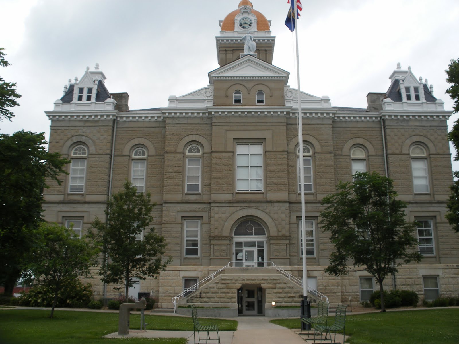 |
| Jefferson County Courthouse (WOW!) - Fairbury |
Jefferson County was once part of a much larger county designated as Jones County. The Legislature determined that Jones County's land area of 706,560 acres was too large so in 1870 it separated the area into Jefferson and Thayer Counties. The county was named Jefferson in honor of Thomas Jefferson, the third president of the United States.
The Oregon Trail and Pony Express Route both passed through what would become Jefferson County, paralleling the Little Blue River. The famous Rock Creek Station was built along the trails. History has it that James "Wild Bill" Hickok first came into prominence as a result of a fight at the station. Hickok was apparently tending stock for the Ben Halliday Stage Company at the station when it was alleged that he killed three men. Hickok was put on trial in Beatrice and pleaded self defense. When no one appeared at the trial to testify against him, the case was dismissed.
The county seat of Fairbury was surveyed and platted along the Little Blue River about a year before Jefferson County was organized. The settlement was a popular place for the Otoe tribe to visit since it was close to their reservation.
Jefferson County's stately, ornate courthouse dates back to 1891 and is listed on the National Register of Historic Places.
JUNE 27
Saline – 22 – Wilber
 |
| Saline County Courthouse - Wilber |
At the time Saline County was organized, the settlement of Swan City Swan City
In 1871 an election was called to settle a contest that had developed over where the county seat should be located. Vying for the honor were Swan City , Crete, Dorchester and Pleasant Hill Swan City to Pleasant Hill
Within six years this issue would surface once more and a special election would be called for Sept. 4, 1877. In the first of what would be three elections that year, Pleasant Hill , Crete, Wilber, Dorchester , Friend and Center competed. Since none of the sites received a majority vote, another election was held two weeks later. This time voters were asked to choose from Pleasant Hill , Crete and Wilber. Once again a majority was not gained by any of the three and the election served only to eliminate Pleasant Hill Crete with a majority of 230 votes.
The cornerstone for the present courthouse in Wilber was laid on June 5, 1928 and 12 months later the building was formally dedicated.
Gage – 3 – Beatrice
 |
| Gage County Courthouse - Beatrice |
Some have disputed that Freeman could have filed the nation's first claim as there were more than 100 land districts that were opened simultaneously throughout the country. But to this day the honor remains with Freeman and the county in which he homesteaded.
The county would be officially organized in 1857. Within a year the townsite of Beatrice was incorporated in the center of the county and in 1859 it was confirmed as the county seat.
The county's first courthouse was built in 1870, but within 15 years the building had become too dangerous and county offices were moved to a nearby bank building. In 1891 the present Richardsonian Romanesque courthouse was built. Its grand design, once lauded by Laura Ingalls Wilder, was destined to become a landmark. In 1960, however, that nearly changed when a fire destroyed much of the building's interior. Voters rejected a proposal to build a new courthouse. Rather, they favored restoring the 69-year-old building. It turned out to be a wise decision, as the restored building was named to the National Register of Historic Places in 1990. The following year the 100th anniversary of the courthouse was commemorated with a rededication ceremony.
Johnson – 57 – Tecumseh
A national television audience received a good look at the Johnson County
When the film crew left Tecumseh in May 1986, the courthouse square quickly returned to normal. But as a result of the filming, the Victorian Style brick building, which is listed on the National Register of Historic Places, had received a fresh coat of paint on the trim, new window blinds, and a large gazebo on the front lawn. The year after the movie aired, the county celebrated the courthouse's 100th anniversary.
 |
| Johnson County Courthouse - Tecumseh (WOW!) |
 |
| Johnson County Courthouse - Tecumseh |
With completion of the Brownville to Fort Kearny and Nebraska City
JUNE 28
Pawnee – 54 – Pawnee City
As one would conclude, Pawnee County and the county seat of Pawnee City Pawnee City
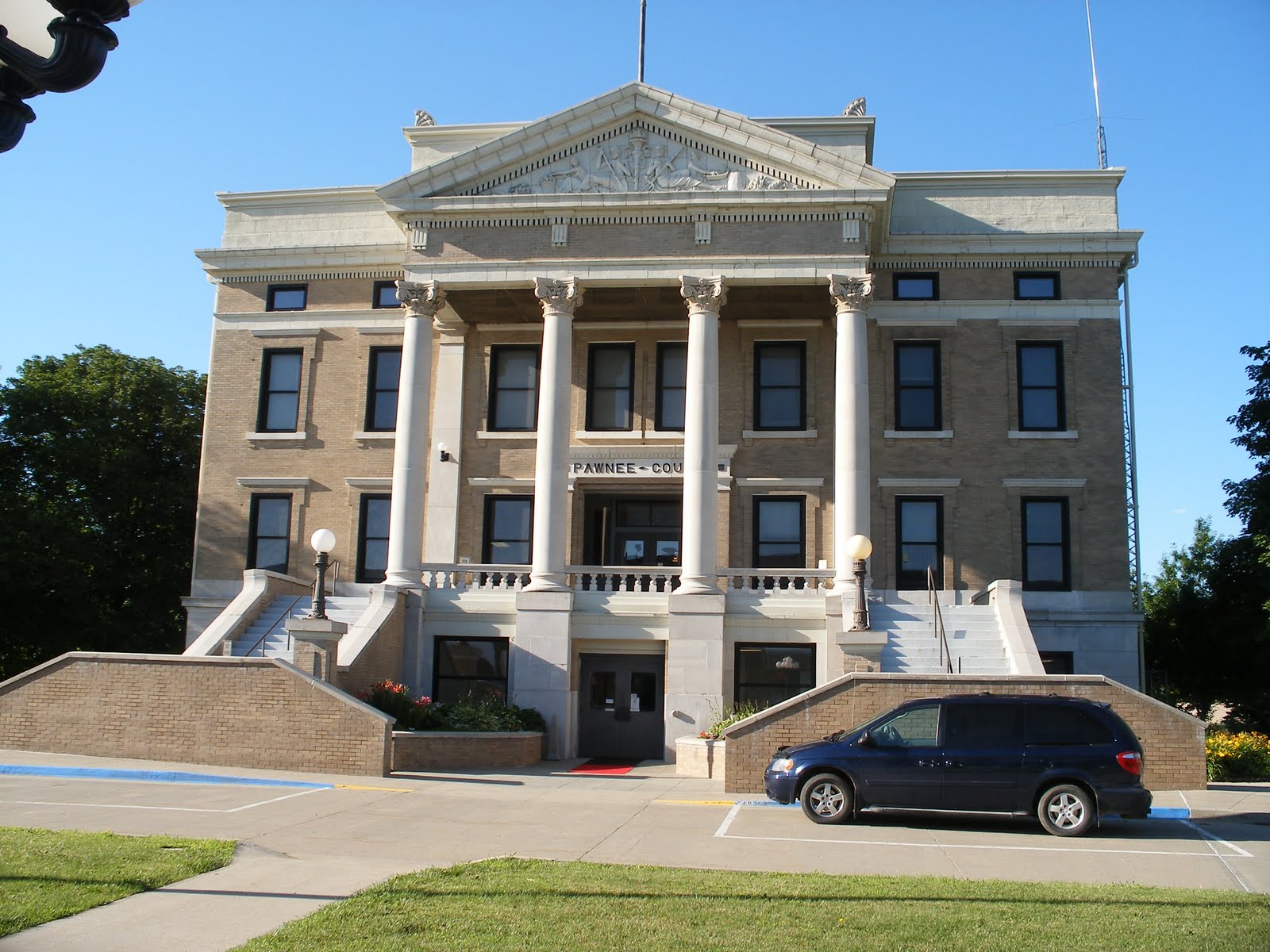 |
| Pawnee County Courthouse - Pawnee City |
The county boundaries were defined by the Legislature in 1855, redefined the following year, and reapproved in 1862. The first election was held in 1856 and it was decided that Pawnee City
Nine years latter, efforts were renewed to build a permanent structure and a two-story limestone building was completed at a cost of just over $15,000. Despite some remodeling and renovation projects, the courthouse proved to be too small. In 1911, $85,000 in bonds was approved for the construction of the present courthouse. Once again made of limestone and brick, the building features a decorative relief sculpture over the building's main entrance.
The earliest settlers of record to make a claim in this area were from Ohio Missouri , Christian Bobst, Robert Turner, Jacob Adams and Robert Archer crossed over into the Nebraska Territory and settled along the south forth of the Nemaha River Cincinnati , in honor of the city in their native Ohio
In more modern times, the advancement of farming throughout the area and the coming of the rail lines helped Pawnee County
 |
| Richardson County Courthouse - Falls City |
In the early years the area of Richardson County included what is today Pawnee County
Embedded deep in the history of Richardson County is the famous John Brown's Underground Railroad, a secret network of cooperation which aided slaves in reaching sanctuary in the free states and Canada
In 1872 a proposal to issue $25,000 in bonds to build a stone and brick courthouse did not meet with the approval of the county's voters. The following year the proposal was scaled back to $15,000 and this time it was successful. The courthouse that was built would stand until May 1919, when it was destroyed by fire.
The following July an election was held to levy five mills on the county's valuation for the purpose of building a new courthouse. Although voters approved the levy, construction on the present courthouse did not begin until 1924.
Nemaha – 44 – Auburn
Another of Nebraska 's counties that derives its name from Indian lore is Nemaha County Missouri River . A stream which crossed the land and emptied into the Missouri
In 1854, Richard W. Brown became one of the first pioneers in the area. Brown crossed the Missouri River in a canoe and laid out a cabin claim along the west bank. Within two years the town of Brownville
There is an interesting history behind the present county seat of Auburn Sheridan Sheridan Burlington New York native Charles Nixon, who had an interest in the land through which the railroad ran, suggested the unified town be known as Auburn , after Auburn , N.Y.
According to historical accounts, a frame courthouse was built in the middle of the two former towns. For many years this united town would be referred to as North Auburn and South Auburn .
The original frame courthouse would soon be replaced when in 1900 the cornerstone was laid for the present courthouse.
Otoe – 11 Nebraska
Two years before the Nebraska Territory would be granted statehood in 1867, William R. Craig and F.W. Wood completed a grand two-story brick building that 129 years later holds the honor of being the oldest public building in Nebraska
Otoe County was defined by the Territorial Legislature on March 2, 1855, the same year that Nebraska City Missouri River . Otoe is derived from Oto, the Indian abbreviation of Watota, which means "lovers of pleasure."
 |
| Otoe County Courthouse - Nebraska City |
When the county was created, Nebraska City Nebraska City
Whether it was by design or by chance, when the courthouse was built in 1865 it was built on ground that was once part of an Indian cemetery. When it was completed, the courthouse cost $22,500. County offices were located on the build's first floor, the District Court on the second floor, and the jail in the basement.
 |
| The Otoe courthouse was built in 1864, before Nebraska was a state! |
The first addition to the courthouse was made in 1882 with a wing added to the west end. In 1936 it became apparent that additional space was once again needed and an identical two-story wing was added to the east side of the original courthouse. Ironically, the second addition cost nearly three times what the original courthouse cost 71 years earlier.
Today, the Otoe County Courthouse is among those listed on the National Register of Historic Places.
Also rich in the history of Otoe County is J. Sterling Morton, who served as Secretary of the Nebraska Territory
JUNE 29
Cass – 20 – Plattsmouth
Douglas County is one of the eight counties that made up the original Nebraska Territory Missouri River to the government for settlement. It was the responsibility of acting Gov. Thomas B. Cuming to divide the land into counties based on census figures.Douglas County Omaha Civic Center
Sarpy County has the honor of having within its boundaries the oldest settlement on record in Nebraska Missouri River in 1805 by Spanish adventurer Manuel De Lisa. According to historical accounts, upon his arrival De Lisa was so taken by the natural beauty of the area that he exclaimed, "Belle vue."Sarpy County was once considered a part of Douglas County Sarpy County Bellevue
Lancaster – X – Lincoln
Lancaster County Lancaster Lancaster would eventually become known as Lincoln , in honor of President Abraham Lincoln, while the county would retain the name Lancaster , after Lancaster , Pa. , and Lancaster , England
JUNE 29
Cass – 20 – Plattsmouth
Long before Cass County Missouri and Platte Rivers Omahas
 |
| Cass County Courthouse - Plattsmouth |
Early explorations of the area have been traced back to those of the French in the 1730s. Following a series of explorations in the early 1800s, trappers began to frequent the area in the 1820s and 1830s. Sometime around 1848 a Mormon named Libeas Coon established a ferry across the Missouri River for the convenience of the Mormons who were moving west. This resulted in a trail along the south side of the Platte River
The first federal government permit to settle in the area was issued to Samuel Martin, who in 1853 built a log house and trading post known as the "Old Barracks" near the confluence of the Platte and Missouri Rivers Glenwood , Iowa
When the boundaries were officially adopted by the Legislature in 1855, the county was named in honor of Gen. Lewis Cass, an American statesman and patriot. In that same legislative act, Plattsmouth was designated as the county seat. The county's boundaries were redefined to their present dimensions the following year.
Despite three petition and special election attempts to move the county seat, the last coming in 1880, the courthouse has always remained in Plattsmouth. The original frame building was used until it was outgrown in 1891, at which time bonds were approved and the present courthouse was constructed.
Douglas – X – Omaha
 |
| Douglas County Courthouse - Omaha |
The fact that Douglas County Omaha
When it came time to locate the territorial capital, Omaha Nebraska was admitted to the Union in 1867, at which time it was moved to the present city of Lincoln
Even though the capital was relocated to Lincoln , Omaha and Douglas County Omaha Omaha
Sarpy – X – Papillion
 |
| Sarpy County Courthouse - Papillion |
Meriwether Lewis and William Clark had actually visited the area the preceding year during their famous expedition to find the headwaters of the Missouri River . But De Lisa is credited with being the first white settler in the area.
In 1810, the American Fur Company established a trading post on this site. Col. Peter A. Sarpy was placed in charge of the post and it is in his honor that the county was eventually named. Traders for hundreds of miles to the north and west brought their furs to the post. The West Coast gold rush of 1849 brought a second wave of trading action to the area.
When the Indian title to the land expired in July 1854, the area was opened to pioneers for settlement. A short time later a steam ferry across the Missouri River went into operation to enhance immigration.
A settlement on a plateau just west of Bellevue Sarpy Center Sarpy Center
In 1856 a government surveying party made a discovery that would lead the way to the organization of Lancaster County
The years that followed yielded little progress and it was not until passage of the Homestead Act that settlers began making their way to the area.
 |
| Lancaster County Courthouse - Lincoln |
As with many other counties, the railroads played an important part in the area's early development. But what possibly helped the area the most was when Nebraska was admitted to the Union in 1867 and the quiet village of Lancaster
A developing agricultural base throughout the county led to Lincoln University of Nebraska Lincoln
The growth of the county and Lincoln County-City Building
Seward – 16 – Seward
The boundaries of what today is Seward County were defined by the Territorial Legislature on Jan. 26, 1856. The original name given to the county was Greene, after a Gen. Greene of Missouri. But when the Civil War broke out Gen. Greene joined the Confederacy so on Jan. 3, 1862, members of the Territorial Legislature voted to rename the county in honor of William A. Seward, Secretary of State under President Abraham Lincoln.
 |
| Seward County Courthouse - Seward |
A unique part of Seward County's history was the development of the present courthouse and the benefactors who contributed to it.
As the number of county records accumulated, it became apparent that a larger fireproof building was needed. Several times between 1879 and 1900 the idea was proposed, but each time it failed due to the anticipated cost. In 1900, Lewis Moffitt, who owned the land on which the city of Seward is located, died. Moffitt's will stated that upon the death of his wife, Mary, his land should be sold and the money be used to build a courthouse and jail at a cost of not less than $100,000.
By 1904 a campaign was well under way to build the courthouse that Moffitt had envisioned. On Sept. 20, 1905, the cornerstone was laid amid a festive celebration that attracted what was estimated at between 8,000 and 10,000 people. As construction progressed there were numerous suggestions on how the county could show its appreciation to the Moffitts. Some even suggested renaming the county in their honor. It was ultimately decided that a plaque honoring the Moffitts be installed inside the courthouse. In 1980 the impressive building and tree-lined courthouse square that were the result of Moffitt's early vision celebrated its 75th anniversary.
York – 17 – York
Nearly 10 years after the original boundaries of what today is York County were created, the area was still considered a land inhabited by Indians. Although an occasional trapper would pass through the area, it was not until 1865 that the first permanent settlement was made by a white man. This marked the beginning of York County and within two years the area had its first post office.
 |
| York County Courthouse - York |
The townsite of York was platted in 1869. Within two years it became apparent that the county was in need of a courthouse. A special election was called to vote on a proposition to sell enough town lots owned by the county to build a courthouse. The question was approved and $1,500 was raised. In 1872 the first courthouse was built. It was replaced in 1886 by a second courthouse that would stand the next 94 years.
In 1980 the present courthouse was dedicated, culminating a 21-year wait. With the previous courthouse beginning to need repairs, the Board of Commissioners decided in 1969 to begin setting aside inheritance tax funds for this purpose. Bond issues in 1973 and 1975 for construction of a new courthouse were rejected and led to a 1977 recall election. In the meantime, inheritance tax and revenue sharing monies had continued to be set aside.
When the special fund reached $2.25 million in 1978, the Board of Commissioners voted to build. County offices were temporarily moved, the old courthouse was razed, and construction of the present courthouse was begun on the same city square that hosted the two previous courthouses. When the $2.3 million building was dedicated on Oct. 19, 1980, it was opened to the public as a debt-free structure.
Hamilton – 28 – Aurora
One-hundred years ago, what was termed at the time as "one of the finest courthouses in Western Nebraska" burned to the ground. But before 1894 came to a close, Hamilton County residents rallied together and began work on a $60,000, three-story, brick and stone courthouse. Next year Hamilton County residents will be rallying once more. This time it will be to celebrate the centennial of their grand courthouse building.
 |
| Hamilton County Courthouse - Aurora |
The 100-year-old courthouse is actually the third to serve the county, which was organized in 1867 and named in honor of Alexander Hamilton, who was Secretary of the Treasury in George Washington's cabinet. The county's first courthouse was built in 1870 in a settlement named Orville City, which was platted along the Blue River. Orville City was intent on remaining the county seat, despite efforts to the contrary.
In 1873 a petition was filed to move the county seat to Aurora. An election followed and Aurora prevailed. Commissioners, however, refused to move and a court order was issued against them. The commissioners fought it up to the Supreme Court, which ruled against Aurora.
Not to be deterred, Aurora residents brought the issue to a second vote of the electorate the following year and again prevailed. The commissioners still refused to move. At that point, 150 supporters of Aurora traveled to Orville City and captured the county records. A court order, however, forced them to be returned to the original county seat.
It would take three subsequent elections before Aurora finally became the county seat. To ensure its victory would stand, Aurora townspeople in 1877 built, without expense to the county, the courthouse that would eventually burn down in 1894.
(Copyright 2004 – Nebraska Association of County Officials)